
This will be a shorter update focusing less on “what could be” and more on what we will do. You can look in Nate Ives’ blog post to see more about the construction of the tracker. I want to go over satellite tracking a little in this post.
For any satellite in low earth orbit there is data about the satellite’s orbit. Organizations like NORAD meticulously track every detectable object in orbit. We track each satellite using two lines of numbers called Keplerian elements. These numbers are based on Johannes Kepler’s laws of planetary motion. They include values for eccentricity, inclination, and more.
Software such as Orbiton or SATPC32 can decode this data, and tell us exactly where the satellites are over the earth at any given time. We can see the predicted orbit path and predict times for when the satellite will be overhead. And furthermore, once we know the orbital path, the software can also tell us where the Satellite is in relation to our location on earth, which direction it is in, and at what angle it is above the horizon. This is called azimuth and elevation respectively.
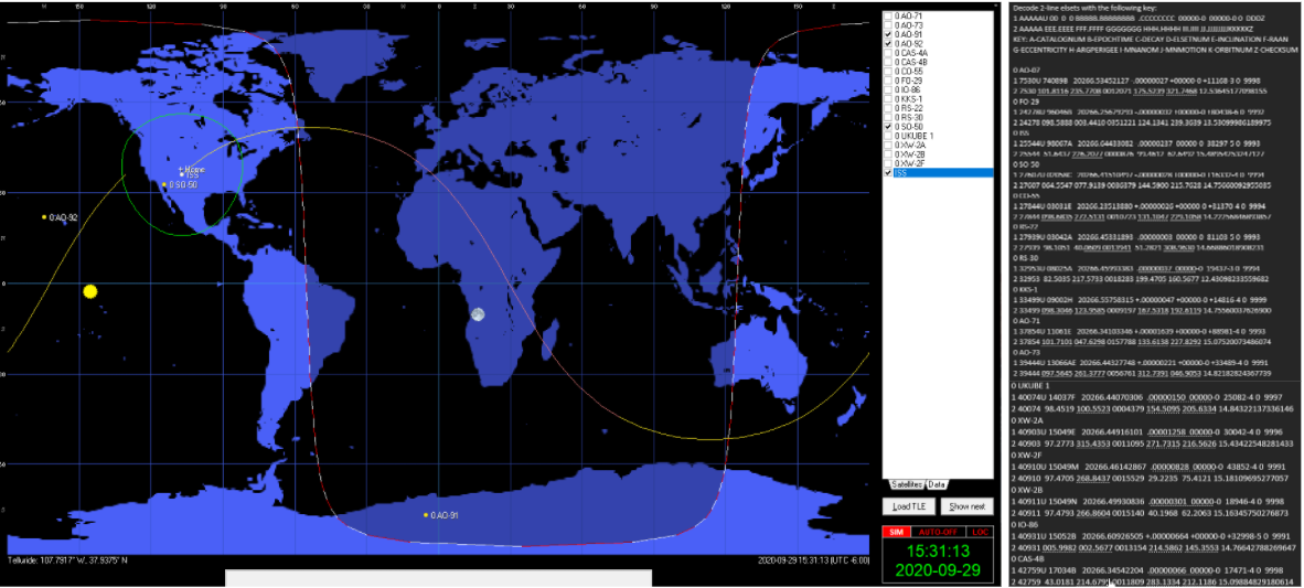
Our azimuth is in degrees of a compass direction (zero degrees being north, and 180 degrees being south) and elevation is degrees of an angle up from the horizon (zero being on the horizon and 90 being straight up. Our satellite tracker will have a built in magnetic compass and attitude sensor. Our azimuth data is fed to a pan servo, which is then cross checked by the compass, and the elevation data is fed to our tilt servo, which is also cross checked by the attitude sensor.
This is how we know where to point our antenna in the sky to receive radio signals from the satellite. And the coolest part is that this is all publicly available information, and we, as high school students with
There are no comments published yet.