

05 Jul Yakelin Ramos- Energy and Geoscience institute at U Utah, Week 3
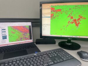
These are the spectral maps, one is zoomed in the other is the entire block that has been captured by the satellite!
Hello! I can’t believe that I’m Already halfway through this internship! To begin this week off I came into office as usual, this time with the job of filling out a worksheet that my mentor had set up for me which bordered around understanding the satellite map that I’ve got, and its a ton of research. I spent a great deal of this week understanding how the map is even made and all its different complexities. For Starters the map is called a minerals spectral map, as this kind of map is specifically made for the purpose of seeing where certain critical minerals. This spectral map uses a satellite that usually goes around and surveys areas using spectral bands it looks at a specific area and then gathers the highest consentration of a mineral present in that area and then that mineral presents itself as a colored pixel for the designated area. Though this technology is not completely accurate as sometimes it looks at vegetation and compares the closest mineral to that plant and says that a certain mineral is present in that area. That is why comparing this spectral map and a regular rap is always helpful to deter any mis-readings. which is what i have been doing for majority of this week but on Thursday I choose three locations of intrest which will be further upon explored.
Outside of doing all of this, I spent time looking around campus where I have yet not been and safe to say that I find the U Utah campus something wonderful. On Saturday, I had the joy of going to watch fire works for the fourth of July celebrations! Along with watching the Backrooms movie which was an amazing experience and I would recommend anyone to watch it if they want a thrilling scare!
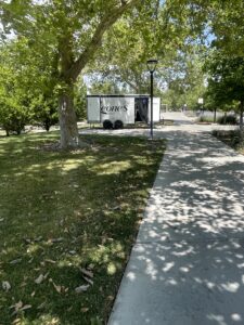
A Barber shop on campus which had a couple of clients inside!!
No Comments